Wrap your class up warm and allow geography advisor Paula Richardson to be your guide as you engage in a cross-curricular exploration...
Preparing for the Poles…
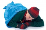
Start a discussion with the children about what it is to be ‘cold’.
• When have they been cold and what was it like?
• What did they not feel like doing?
• Have they seen snow and if so what was that like?
• How does feeling cold affect us and what do we do to get warm?
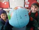
 Look at the area surrounding the North Pole and South Pole on an inflatable globe. Can they find them? How do they relate to each other? Show children a map such as the one at athropolis.com/map2.htm which locates the North Pole in the centre and clearly indicates all the countries within the Arctic Circle as well as the extent of the ice cap. What are the clues on the map that this is a cold area? Talk about the differences – i.e. Antarctica is a land mass covered by snow and ice but the Arctic is made up of frozen water. Ask children to use atlases to determine:
• How they might reach both places and which would be easiest?
• Which countries are nearest to the places?
• Which methods of transport could be used?
• Who or what might be found there?
Ask them to predict which types of creatures might be found in each place as a preparation for another activity. (Whilst many people live in the Arctic region, only seasonal scientists and visitors are allowed in Antarctica.)
Recreate the frozen wilderness in your school…
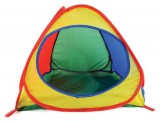
A fun activity for young children is to try and create for them a feeling of being out in such wilderness areas. One way of doing this is to set up a tent in the classroom or outside if appropriate, and equip with sleeping bags, cagoules and backpacks, etc. Use a white tent if possible and encourage children to explore this environment and perhaps sit there to read stories about the Polar regions.
Discuss how they feel after a while – is this a comfortable place or are some things difficult to do without sitting at a table, for example? The aim is to help children understand that not everywhere in the world is as comfortable and easy to live in as where they live. To complete their experience set up the tent in the entrance hall of the school adding appropriate storybooks and equipment, as a display to share with others. A bit of artificial snow might add that finishing touch!
 Are the Polar regions like where we live?
Show pictures of Antarctica and the Arctic to help children to work out what it’s like there. Pose questions:
• What can you see in the pictures?
• What’s missing?
• Can you tell the seasons or time of day?
• What would you feel/hear if you were in this picture?
• How might the picture change if the camera moved left or right?
• Is there any evidence of people or animals here?
• Is there evidence of pollution?
• How do these pictures compare with where we live?
It’s important for them to see a range of different types of locations and times of the year such as summer in Antarctica where some of the snow has melted to expose rocks and gravels. There’s also a volcano in Antarctica, Mt Erebus, which is often a surprise to children.
Look at the temperature in your own area and then investigate temperatures in places such as Barrow Alaska, Murmansk Russia or sites in Antarctica (wunderground.com/global/AA.html). Also check out the web cameras to see conditions in the polar regions. (These aren’t working all the time but have information and pictures). There’s a really interesting map of the world showing night and day as it changes around the world which can be viewed several times a day at fourmilab.ch/cgibin/ Earth?opt=-p&img=learth.evif. All these tasks will help bring the places alive for children so they recognise that they’re real just like the places they already know.
Explore the polar bear capital of the world…
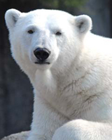
“If you meet a polar bear don’t run away or play dead” says the information sheet to visitors to Churchill! A town on the shore of Hudson Bay, 650 miles north of Winnipeg, Churchill is one of the best places to see polar bears (usually from the safety of a large buggy on wheels). Ask children to locate it on the map and explain that they’re going to create a presentation to inspire people to visit Churchill and have a ‘polar bear experience’. This will mean seeing the bears in their own habitat and they have to remember that whilst bears can look cuddly they generally look at humans as potentially their next meal!
They’ll need to consider:
• When’s the best time to visit?
• What will the visitors do and see?
• How will they travel out to see polar bears in safety?
• Where will they stay?
• What will the weather be like?
• What sort of clothing will they need?
• What are the safety rules for bear watching?
A useful website to get them started is: http://www.greatcanadiantravel.com/tours/polar-bear-tours
 Test their survival instinct…
This is a good decision-making activity for pupils who have some knowledge about cold environments. Ask them to imagine they’re in a small group of four people stranded away from base camp in Antarctica. It’s summertime and they’ll have to fend for themselves for at least 24 hours before they’re likely to be rescued. The first task is to choose, from a list provided, a maximum of eight articles which they’ll find in their backpacks, for instance:
Torch, map, sleeping bags, water, matches, food rations, mirror, book, mobile phone, slippers, small pan, whistle, toilet paper.
They have to consider the nature of summer time in the Antarctic; so, for example, how helpful would a torch be? Water is very important for sustaining life, but in this environment is this already available? How useful would a mobile phone be in an area without phone masts?
Children present and justify their choices on a flip chart to the rest of the class.
 Great new resources from the Geography Association…
Paula Richardson is joint editor of the forthcoming Geography Plus: Primary Teachers’ Toolkit series, published by the Geographical Association (GA). The first titles will be available in Spring 2011 and Paula’s book, Living in the Freezer, will be published later next year – visit geography.org.uk/shop for more information.
Available now, the revised edition of the Primary Geography Handbook has been updated with the latest thinking in the school curriculum. The GA also has a primary membership which includes the journal Primary Geographer and costs just £38 per year for a school. For more information see geography.org.uk
Top tips for differentiation
Ace-Maths
How to use Harry Potter to engage high-ability learners
Ace-Languages
How children react to a moral dilemma may be down to your teaching
Ace-Classroom-Support
